
need help with saved files, thousands of them.

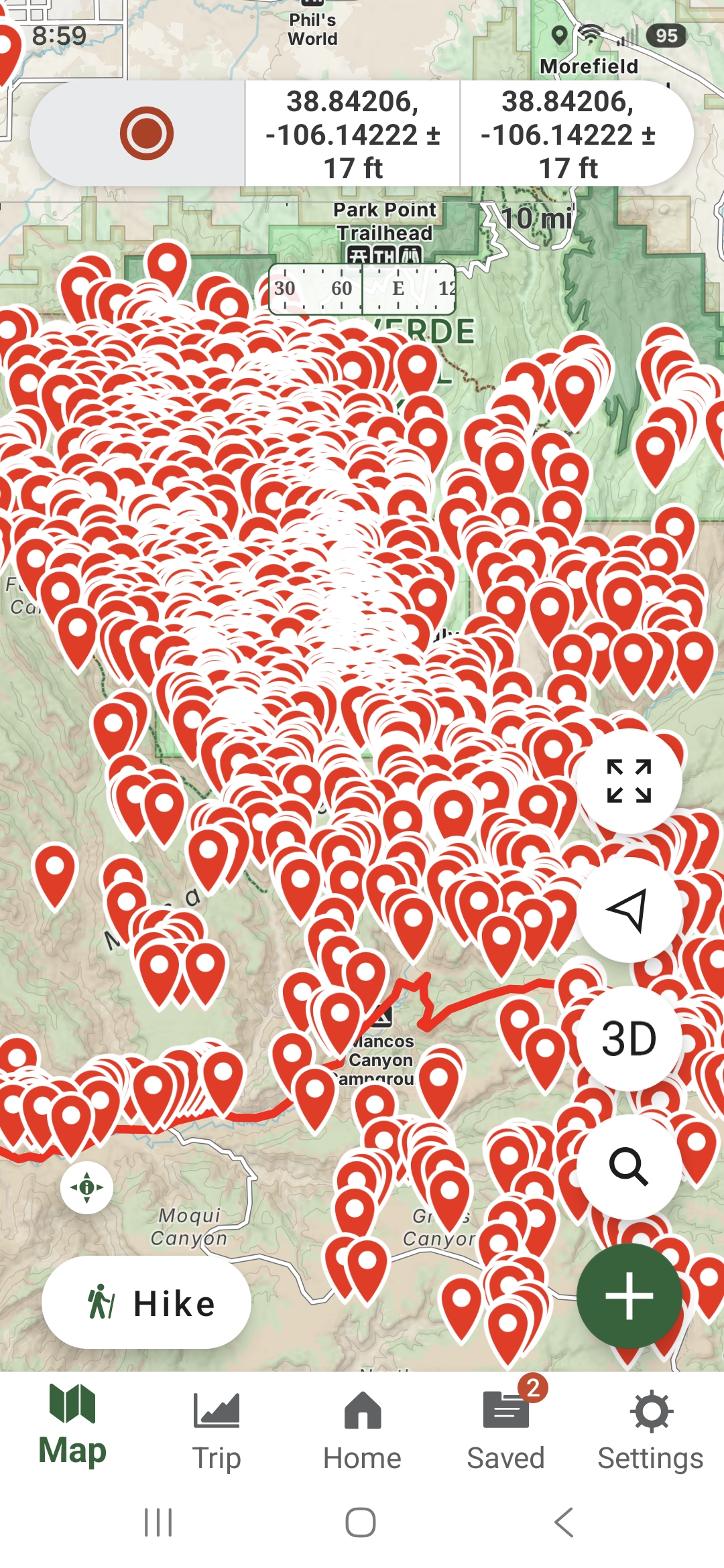
I downloaded a gpx of archeological sites. Turns out there's over 4,000 individual sites. Mostly centered around the 4 corners area. So when I open the map the screen is covered with little red points.
I can't figure out how to turn this off. And then be able to turn back on when I actually want to find one of the sites.
Edit to add: I talked to a friend who has the same files. On his phone there will be a bubble with a number indicating how many are near that point. zoom in and the bubble splits off, then down into individual sites. That's what I want to accomplish.
Is it because he uses apple and I'm on a samsung?
Thanks in advance.
Here is a screen shot of what it looks like.
-

At the bottom there to the right click on SETTINGS > Map Controls and scroll down to Cluster Waypoints. That option should be turned on, it puts waypoints into a cluster with a number. when you zoom out so it doesn't take a lot of space.
When you zoom in, it will show the individual ones as you get closer to them.
0 -

In the Android app, you can cluster the waypoints while zoomed out by going to “Settings > Map Controls” and toggling on “Cluster Waypoints”.
As far as hiding and showing all of the imported waypoints, there's likely a way to do this by creating a folder in the “Saved” section of the app and moving the waypoints into it. You can then show or hide anything in the folder by clicking the eye icon next to the folder. More about folders here: https://help.gaiagps.com/hc/en-us/articles/115003525187-Managing-Folders-on-Android
0
Vous devez vous connecter pour laisser un commentaire.
Commentaires
2 commentaires