
Fining 4x4 trails

Completely new to Gaia, please have patience with me!
I purchased the premium plan. I want to use Gaia to find 4x4 trails. So far I am struggling with this. I have used multiple different overlays and sometimes I can see the trails but if I tap on it, it just highlights that spot and provides virtually zero information.
I noticed that if I use the "discover" button and filter by 4x4 it shows trails "nearby". However what if I wanted to see another section of the state (that I am currently not nearby) I can't figure out how to do this. When I use the 4x4 filter and pic a trail then it highlights the whole trail on the main map and gives you tons of details. Is there a way just to tap on the map and see if its a 4x4 trail? Tapping on the main map doesn't seem to highlight a trail and show you where it starts/stops.
Basically I want to be able to search another part of the state for 4x4 trails and have them all listed on the map.
Currently maps in use:
USFS Recreation Sites
MVUM (USFS)
USFS Roads and Trails
USFS 2016
NatGeo Trails Illustrated
-
Official comment

Hi everyone,
Thanks for posting. I can definitely see how this would be a helpful feature and I too would find this to be useful when searching for 4x4 trails outside my area.
While this currently isn't on the roadmap, I appreciate the feedback and wanted to let you know that we are listening.I also wanted to let you know that you might find the search on our website helpful, as you can search for hiking/4x4 outside of your vicinity.
See this link for an example:
https://www.gaiagps.com/hike/city/united-states/colorado/buena-vista/?activity=4x4
-

Following...
0 -

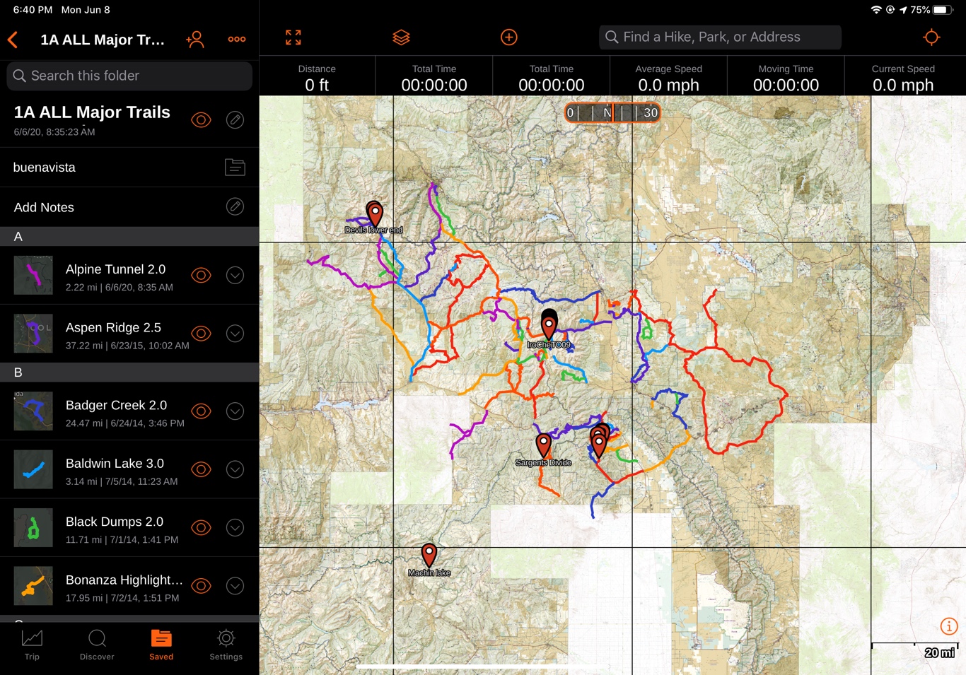
I downloaded gpx files from “https://www.jeeptheusa.com/”. Then on my MacBook I logged into the Gaia website and created folders. For example, jeeptheusa, then Colorado and then Buena Vista. I then uploaded the Buena Vista gpx files (4) and moved them into the Buena Vista folder under Colorado.
Now when I open Gaia on my iPad I can browse all the trails nearby and plan my trips. What is nice they are color coded on the JeepTheUsa website to know what are roads vs trails.
Billy Menasco
 0
0 -
Well that’s pretty disappointing. This seems like basic functionality for a program. If I have to go to websites to do this I just need google maps then. I guess I won’t be renewing. Especially since you don’t even plan on implementing it. Hopefully this post helps future purchasers know this severe product limitation.
0
Please sign in to leave a comment.
Comments
4 comments