
Satellite Maps VERY pixelated.. almost not usable

Up in Canada here and been playing with GIA. got the premium membership expecting the best experience on the market. Seems like USA satellite maps are all fantastic, can zoom in as if its google maps however 1/3 of all trails up in Canada I am trying to build are not even possible due to a lack of satellite images loading. some areas are not rendered right and so pixelated you can't even tell what your looking at.
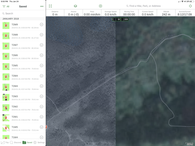
Is Gia working on a patch for this, is there something that can correct what is rendering?? I have attached a picture of what I am referring to showing half the map rendered and the other half not rendered.
-

@dkolba
I'm sorry there is an issue with the satellite imagery for the trails you are looking at.
Can you let me know the coordinates of the area in your screenshot so I can look into this further?0 -
one specific location for example is 50.39380, -96.17303
0 -
@dkolba
Thanks for getting back to me.
I reported this issue MapBox, the map source provider.
If you find areas like this on the Satellite map, you are able to report them directly to MapBox and they'll be able to look into fixing it here: https://apps.mapbox.com/feedback/
In the meantime, I recommend trying on the WorldImagery map from ESRI:
https://www.gaiagps.com/map/?layer=esriworldaerial&lat=50.3908&lon=-96.2219&zoom=120
Please sign in to leave a comment.
Comments
3 comments