
Which is Correct Elevation: Route Profile or Topo Map Lines?
When I slide a finger along elevation profile while editing the route in iPad, it gives me the elevation at a given point. However, what I have found that in most cases this elevation is different from what I read from the top map elevation lines. Take for instance the following screenshot: the route profile elevation of 1723m cannot be true when the point is between 1700 and 1710m lines of the topo map. In fact, most iPad elevations between these topo lines are showing up incorrectly. I have added another screenshot also to illustrate the point. And this is not the isolated case of this route. I have found this to be true in most routes that I have worked on recently.
Question is: While I understand that no maps or GPS applications are 100% correct, which elevation should I take as more correct in such a case: Topo Line or Route Profile? My objective is to estimate the elevation gain as accurately as possible between two points and calculate the grade of ascent using these elevations for my routes.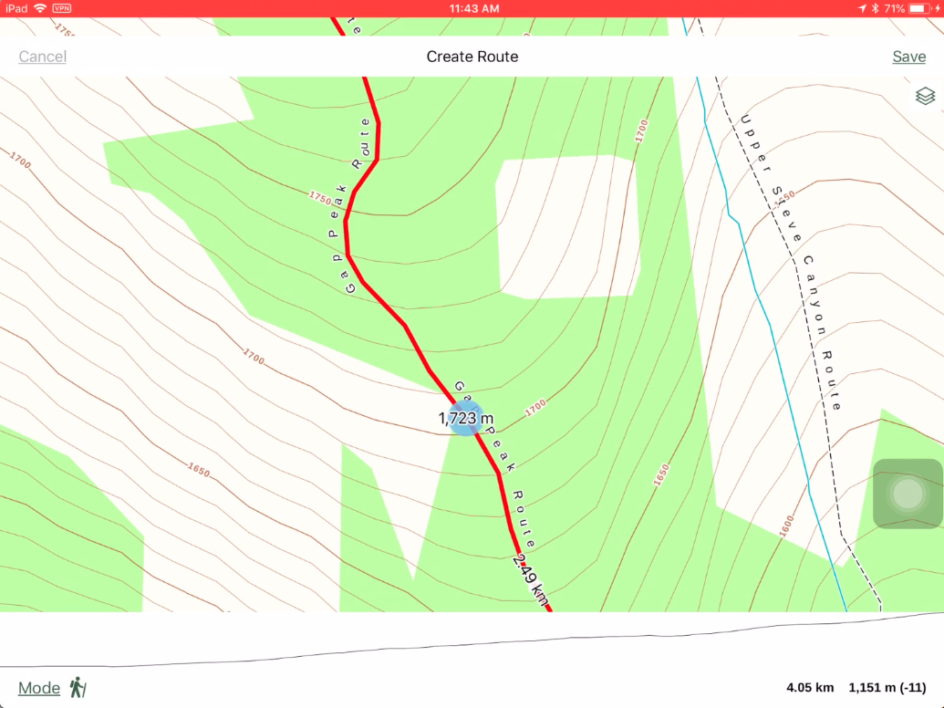

Please sign in to leave a comment.
Comments
0 comments