
Topo lines missing in Custer State Park, SD
Answered
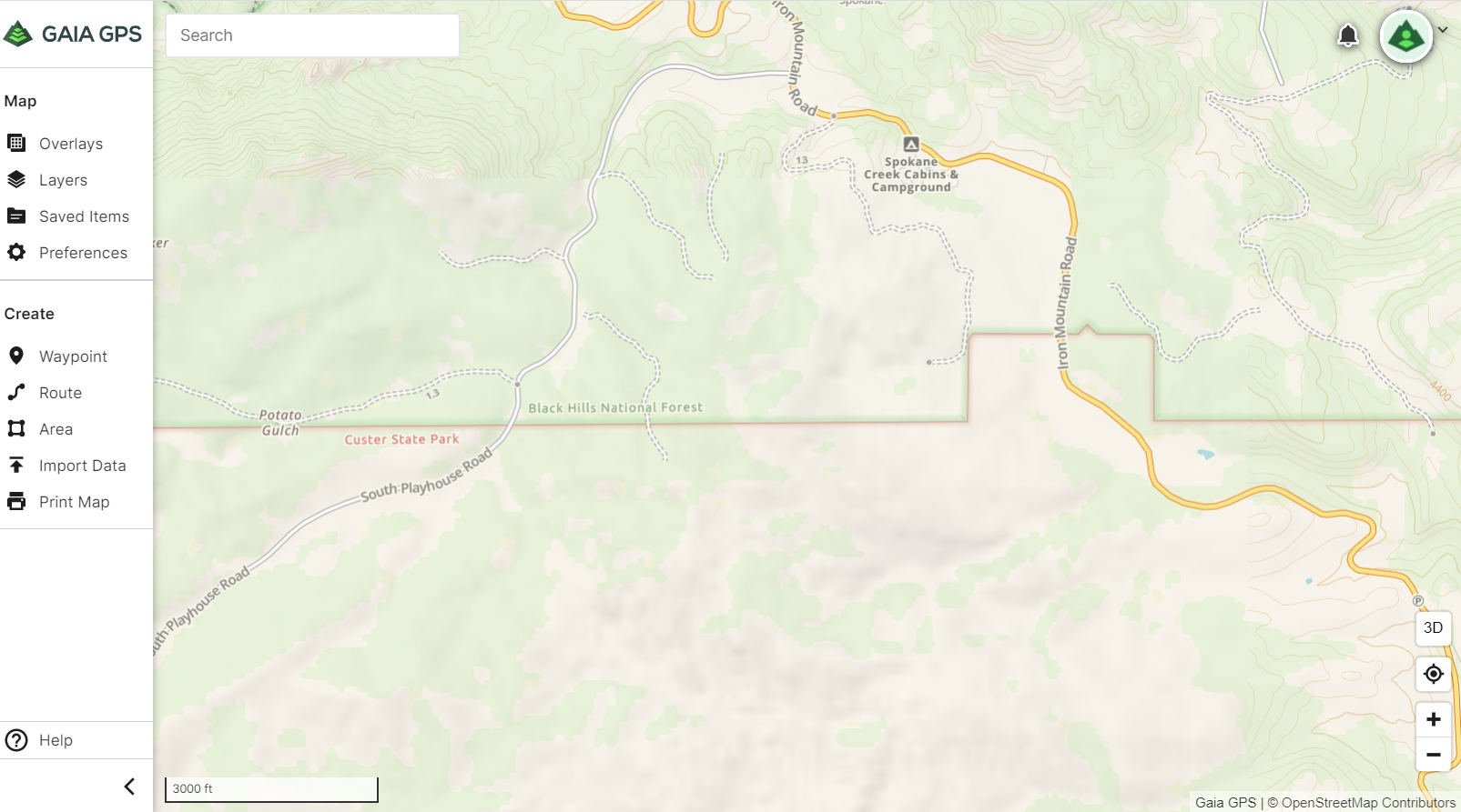
I noticed a large section of topo lines missing from the Gaia Topo layer in both the app and online. The area is in the vicinity of Custer State Park in the Black Hills of South Dakota. This screen shot shows the NE corner of the affected area. The hill shading is still there, but the contour lines are missing.
I also noticed a number of missing or inaccurate forest service roads in the area. I started updating them in OpenStreetMap, but most of them are missing from that map. If I map the forest service roads in OpenStreetMap, will the Gaia GPS map be able to handle roads that are duplicated between both maps? Is there a way to make changes directly to the forest service road map that Gaia GPS uses?
-

Hey @luke.zwiefelhofer,
I've alerted the Map Team about the missing contour lines near Custer State Park, South Dakota.
Gaia Topo uses both OpenStreetMap and USFS data. Any roads that you add in OpenStreetMap will show up on Gaia Topo in two to three weeks.
The Gaia GPS map will be able to handle roads that are duplicated between both maps.
It is not possible to make changes directly to the forest service road map. You can only contribute updates to OSM.
If you have any further questions, please contact Support here.0
Post is closed for comments.
Comments
1 comment