
Route Planning Error on River Road West - Big Bend National Park
Answered
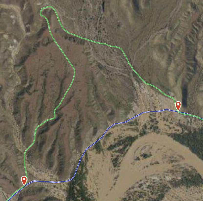
I planned a route from the eastern end of River Road to the western end in Big Bend National Park (Blue Route shown below). I was traveling westbound. At one point the "planned" route would have taken me through terrain that was completely impossible to cross. I continued along the road I was on (Green Route, below) and eventually it rejoined the planned route.
The eastern point where the tracks diverge is at 29.04792, -103.34150. The western point where the tracks converge is at 29.04366, -103.35156.
Is there any way to get Gaia to correct this?
-
Official comment

Hi @Terry,
Snap-to-trail routing uses trails and roads displayed on the Gaia Topo map source. Gaia Topo, as well as several other sources in the app, are based on OpenStreetMap data, an Open-source and public mapping project.
It sounds like this road may be out of date in OSM. You can actually contribute to OSM in order to add trails and features to the map. Read more about this and find instructions here: Contribute to OpenStreetMap
If you decide to contribute any updates to OpenStreetMap, you'll see the changes in Gaia GPS in two to three weeks.
If you have any further questions, please contact Support here.
Post is closed for comments.
Comments
1 comment