
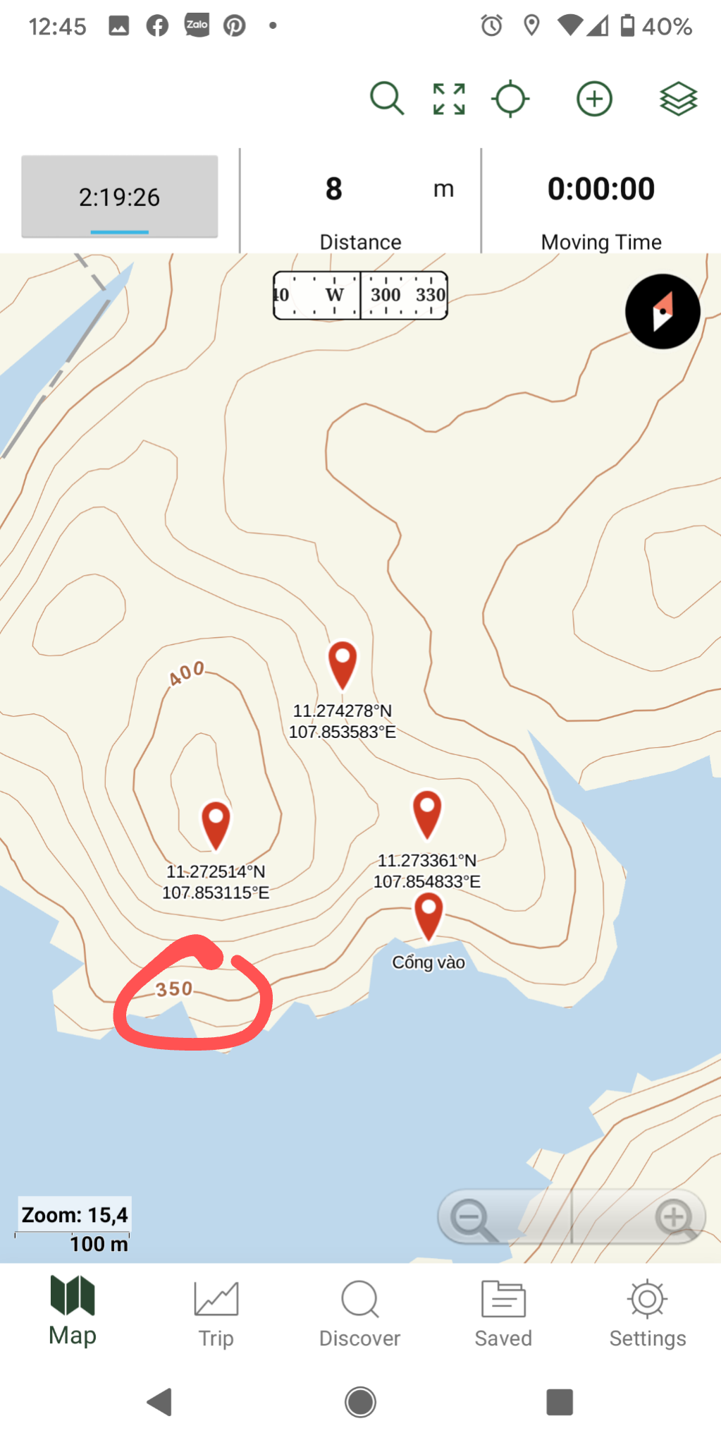
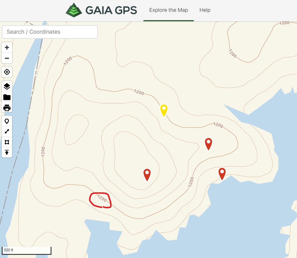
The line shows the different altitudes between your computer and phone.
Answered
Hi.
The line displays the altitude above sea level on a computer map differently than on a phone, in the same location.
0
-

Hello:
I'm pretty sure the difference is that contours are in different units. the 1200 is likely feet with the 350 probably meters.
Assuming the map is GaiaTopo in both cases I'd guess one is GaiaTopo (feet) and the other GaiaTopo (meters).
Howard Snell
0 -

@bokoradventure,
@snell nailed it. It looks like you're using Gaia Topo (feet) on the web and Gaia Topo (meters) on your phone.
0
Please sign in to leave a comment.
Comments
2 comments